Earthquake of 3.8 magnitude strikes Myanmar
Nov 24, 2025
Naypyidaw (Myanmar), November 24 : An earthquake of magnitude 3.8 hit Myanmar on Monday evening. The tremors were recorded at 5:39 pm, according to the preliminary data. The quake was centred at a depth of 139 km, at a latitude of 24.96 °N and a longitude of 95.12°E.
The National Centre for Seismology (NCS) gave information about the earthquake on X.
The post read, "EQ of M: 3.8, On: 24/11/2025 17:39:51 IST, Lat: 24.96 N, Long: 95.12 E, Depth: 139 km, Location: Myanmar."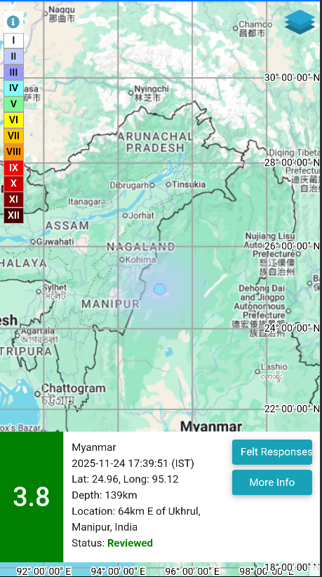
Meanwhile, an earthquake of magnitude 3.9 struck Bhutan on Sunday afternoon, according to NCS.
Earlier, on November 16, Myanmar was struck by an earthquake of magnitude 3.5. As per the NCS, the earthquake occurred at a shallow depth of 10km, making it susceptible to aftershocks.
Myanmar is vulnerable to hazards from moderate and large magnitude earthquakes and tsunami hazards along its long coastline. Myanmar is wedged between four tectonic plates (the Indian, Eurasian, Sunda, and Burma plates) that interact in active geological processes.
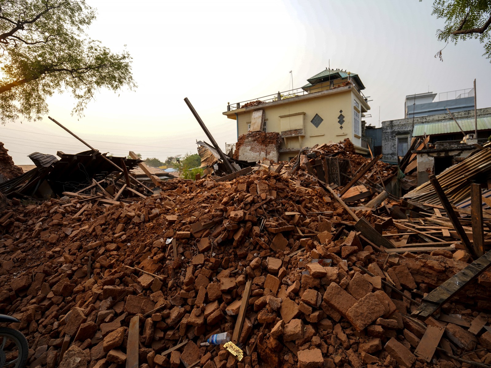
In the aftermath of the magnitude 7.7 and 6.4 earthquakes that struck central Myanmar on March 28, the World Health Organisation (WHO) warned of a series of rapidly rising health threats for tens of thousands of displaced people in earthquake-affected areas: tuberculosis (TB), HIV, vector- and water-borne diseases.
A 1,400-kilometre transform fault runs through Myanmar and connects the Andaman spreading centre to a collision zone in the north called the Sagaing Fault.
The Sagaing Fault increases the seismic hazard for Sagaing, Mandalay, Bago, and Yangon, which together represent 46 per cent of Myanmar's population. Although Yangon is relatively far from the fault trace, it still suffers from significant risk due to its dense population. For instance, in 1903, an intense earthquake with a magnitude of 7.0 that occurred in Bago also struck Yangon.