Mandi, Kangra records highest rainfall of 20 cm; snowfall observed across Himachal Pradesh: IMD
Feb 03, 2026
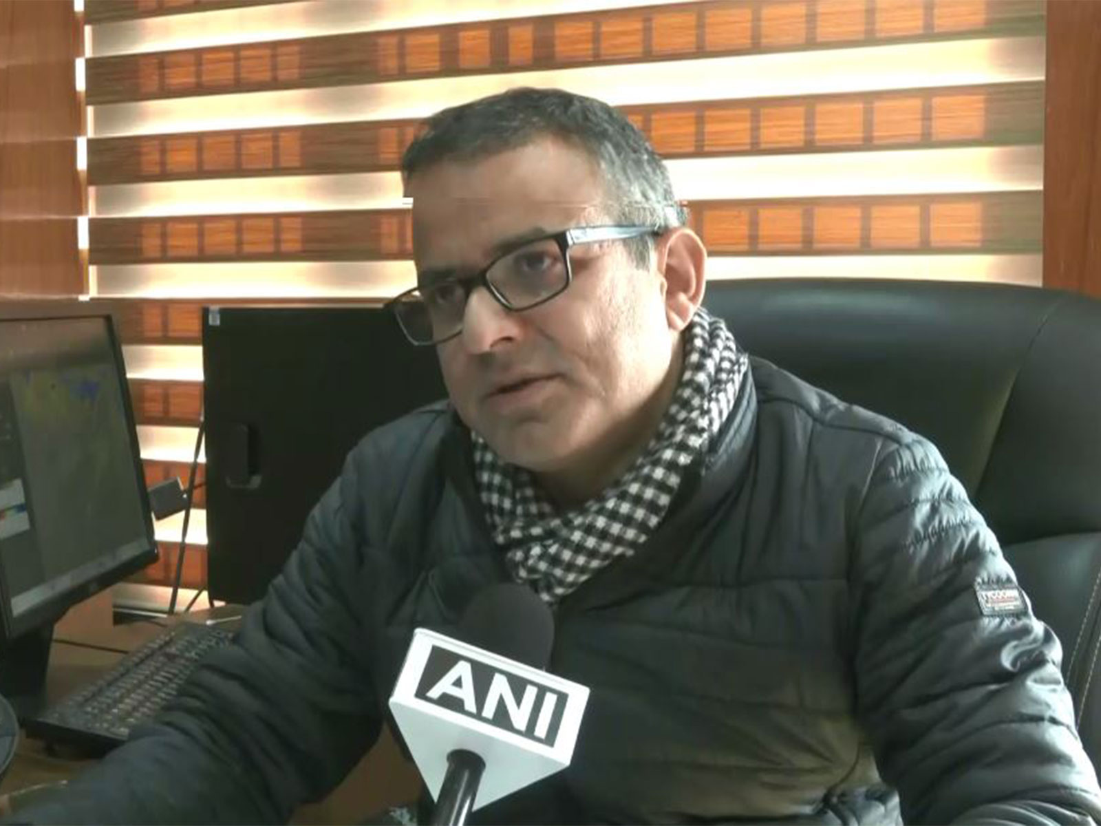
Shimla (Himachal Pradesh) [India], February 3 : Senior Scientist at India Meteorological Department (IMD), Sandeep Kumar Sharma, on Monday, stated that there has been an active western disturbance with light to moderate rainfall and snowfall across Himachal Pradesh, with the highest rainfall received across Kangra and Mandi.
"In the last 24 hours, due to the active western disturbance, light to moderate rain and snowfall were recorded across Himachal Pradesh. The highest snowfall of 15 cm was reported from Kothi in Kullu district, followed by 13 cm in Kalpa, 8 cm in Sangla, and 7 cm in Jot. Light snowfall was observed in Kufri in Shimla and Manali..." he told ANI.
Sharma said that various parts of Mandi and Kangra received the highest rainfall of 20 cm, followed by a dip of seven degree Celcius in temperature.
"Rain accompanied by thunderstorms was recorded in parts of Mandi and Kangra, with Gohar in Mandi district receiving the highest rainfall of about 20 mm. Daytime temperatures dropped sharply due to snowfall and cloud cover, falling by as much as seven degrees Celsius in some places. Cold wave-like conditions were recorded in Manali and Mandi, where maximum temperatures remained significantly below normal. Dense fog was reported in Bilaspur, while shallow to moderate fog was observed in Mandi and Sundernagar this morning..." he added.
Regarding the upcoming weather, on Monday and Tuesday, he said that the higher altitude regions such as Kullu, Spiti, Kangra, and Chamba might witness rain and light snowfall. Although for most regions, the weather will mostly remain clear from February 4 to February 8.
"The highest districts like Chamba, Kangra, Kullu, and Spiti may experience rain and light snowfall. Shimla and Mandi have a slight chance of light rain in only one or two areas, that too in the late afternoon or evening. In other areas like Una, Bilaspur, Nurpur, Solan, etc., the weather will remain mostly clear. The forecast is similar for today and tomorrow. From February 4 to 8, the weather will remain mostly clear throughout the state..." he said.
Further, he informed of a weak western disturbance on February 6, which will cause light snowfall in areas like Chamba and Lahore.
"Only on February 6, there will be a feeble Western Disturbance that affect the region. Due to this, there has been a light snowfall in some areas in Chamba and Lahore. In the last 24 hours, the temperature of the day has fallen significantly due to the rainfall and snowfall activity..." he stated.
Sharma said that the temperature will rise till February 4. After that, there will be no significant change till February 5. The temperature from February 6 to 8 will gradually rise by 2 to 3 degree Celcius.
There is no possibility of any significant change in the forecast. When the weather opens up, it can fall 2 to 3 degrees, he said.
Meteorologist GNRS Srinivasa Rao told ANI that the cold conditions across Telangana are heading towards the end, with temperatures rising since mid-January. Minimum temperatures now range between 14 and 19 degrees Celsius, while maximum temperatures are around 28 to 32 degrees.
He said early-morning fog may continue for the next three to four days due to moist easterly winds, warning highway travellers of low visibility between 3 am and 8 am. In Hyderabad, temperatures are also climbing, though fog may persist in the outskirts and near Shamshabad airport.