Fishing boats stay anchored in TN, Andhra coasts as cyclonic storm 'Motha' intensifies
Oct 27, 2025
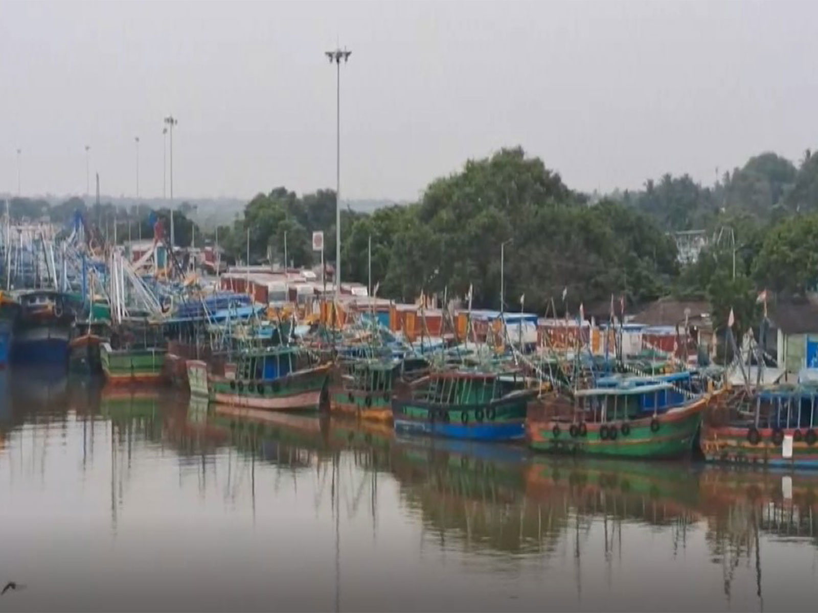
Cuddalore (Tamil Nadu) [India], October 27 : Boats remain anchored at Visakhapatnam fishing harbour on Monday as heavy rainfall lashed the city amid high tidal waves as Cyclone Montha gained in strength.
Boats in Cuddalore, Tamil Nadu also remained anchored at the dock.
Dark clouds were observed over Puducherry due to the storm brewing over the Bay of Bengal.
The East Coast Railway has cancelled several trains for passenger safety.
The weather system, situated over the Bay of Bengal, is likely to intensify into a severe cyclonic storm and make landfall near Kakinada in Andhra Pradesh on Tuesday night, the India Meteorological Department said in a special bulletin.
Director of IMD, Bhubaneswar, Manorama Mohanty said that IMD had issued Red and Orange Alerts for Heavy Rainfall in Odisha from October 27 to 30
A Port Cautionary Warning Signal No. II has been issued for all ports across the Odisha coast, he said adding that fishermen have been advised not to venture into deep-sea areas or along the coast till October 30.
The IMD official said that landslides may occur in hilly areas, and urban flooding situations are likely to prevail during the heavy rainfall caused by the cyclone.
The duty officer at Visakhapatnam Cyclone Warning Centre Jagannath Kumar said, "... Yesterday's deep depression over the southeast Bay of Bengal intensified into Cyclone Montha at 23:30 IST... As of today, it lies over the southwest and adjoining southeast Bay of Bengal... Its current position is approximately 520 km east of Chennai, 500 km southeast of Kakinada, 600 km southwest of Visakhapatnam, and 750 km from Gopalpur... The cyclone is likely to move northwest and intensify into a severe cyclone by tomorrow morning, October 28."
"It is expected to cross Machilipatnam... Wind speeds may gust up to 110 km/h. Thunderstorms are forecast over the next five days, with heavy rainfall expected in coastal districts. Conditions are likely to ease after October 29... Fishermen are strongly advised not to venture into the sea for the next five days due to bad weather conditions..." Kumar said.
A red alert was issued in Odisha due to the cyclone. Chief Fire Officer, Ramesh Chandra Majhi, says, "Odisha CM has directed everyone to ensure that no life is harmed. There are 8 red alert districts, and 123 of our teams have been deployed in all these areas; all the equipment they need is available to them....Dewatering will take place in Bhubaneswar, Cuttack, and Brahmapur. 144 teams will remain here to address urban flooding and other regular incidents. JCBs have been kept in the hilly areas so that the debris can be removed as quickly as possible. It will be safe to leave the house only when the government gives the green signal...I request everyone to follow the guidelines issued by the government."
The Odisha Disaster Rapid Action Force (ODRAF) teams are equipped with rescue boats, motor rafts, power saws, and generators to carry out swift rescue and relief operations. Fire personnel are engaged in search-and-rescue, evacuation, debris clearance, and distribution of essential supplies.
Fire services teams are also assisting local administrations in the large-scale evacuation of vulnerable residents from low-lying and hilly areas to safe shelters. Round-the-clock control rooms are operational to monitor the situation and coordinate rescue and relief efforts.
According to the IMD, Cyclone Motha is expected to intensify into a Severe Cyclonic Storm (SCS) by 11:30 PM and is projected to cross the Andhra Pradesh coast between Machilipatnam and Kalingapatnam, near Kakinada, during the evening or night of October 28th. The maximum sustained wind speeds are expected to be 90-100 km/h, with gusts up to 110 km/h.
https://x.com/Indiametdept/status/1982737034809921880
The IMD said that the cyclonic storm is moving from the southwest and adjoining southeast Bay of Bengal to the northwest at 15 km/h over the past six hours. As of 5:30 AM, it was centered over the southwest and adjacent areas of the west-central and southeast Bay of Bengal, which is approximately 560 km east-southeast of Chennai (Tamil Nadu), 620 km south-southeast of Kakinada (Andhra Pradesh), 650 km south-southeast of Visakhapatnam (Andhra Pradesh), 790 km south of Gopalpur (Odisha), and 810 km west of Port Blair (Andaman and Nicobar Islands).
https://x.com/Indiametdept/status/1982663000155664739
The cyclone is likely to continue moving northwestward for the next 12 hours, before shifting to a north-northwestward trajectory and will likely intensify into a severe cyclonic storm by the morning of October 28.